Abstract:
Radar sounders (RSs) are nadir-looking sensors operating in high frequency (HF) or very high frequency (VHF) bands that profile subsurface targets to retrieve miscellaneo...Show MoreMetadata
Abstract:
Radar sounders (RSs) are nadir-looking sensors operating in high frequency (HF) or very high frequency (VHF) bands that profile subsurface targets to retrieve miscellaneous scientific information. Due to the complex electromagnetic interaction between backscattered returns, the interpretation of RS data is challenging. The investigations of ice-sheet subsurface structures require automatic techniques to account for both the sequential spatial distribution of subsurface targets and relevant statistical properties embedded in RS signals. Automatic techniques exist for characterizing these targets either related to probabilistic inference models or convolutional neural network (CNN) deep learning methods. Unfortunately, CNN-based methods capture local spatial context and merely model the global spatial context. In contrast to CNN, the transformer-based models are reliable architectures for capturing long-range sequence-to-sequence global spatial contextual prior. Motivated by the aforementioned fact, we propose a novel transformer-based semantic segmentation architecture named TransSounder to effectively encode the sequential structures of the RS signals. The TransSounder was constructed on a hybrid TransUNet-TransFuse architectural framework to systematically augment the modules from TransUNet and TransFuse architectures. Experimental results obtained using the Multichannel Coherent Radar Depth Sounder (MCoRDS) dataset confirms the robustness and capability of transformers to accurately characterize the different subsurface targets.
Published in: IEEE Transactions on Geoscience and Remote Sensing ( Volume: 60)
Funding Agency:

Center of Digital Society, Fondazione Bruno Kessler, Trento, Italy
Department of Information Engineering and Computer Science, University of Trento, Trento, Italy
Raktim Ghosh (Student Member, IEEE) received the Bachelor of Engineering (B.E.) degree in mining engineering from the Indian Institute of Engineering Science and Technology, Shibpur, India, in 2016, and the Master of Science degree in geo-information science and Earth observation with a specialization in geoinformatics under the joint education program (JEP) between the Indian Institute of Remote Sensing, ISRO, and the Fa...Show More
Raktim Ghosh (Student Member, IEEE) received the Bachelor of Engineering (B.E.) degree in mining engineering from the Indian Institute of Engineering Science and Technology, Shibpur, India, in 2016, and the Master of Science degree in geo-information science and Earth observation with a specialization in geoinformatics under the joint education program (JEP) between the Indian Institute of Remote Sensing, ISRO, and the Fa...View more

Center of Digital Society, Fondazionae Bruno Kesseler, Trento, Italy
Francesca Bovolo (Senior Member, IEEE) received the Laurea (B.S.) degree, the Laurea Specialistica (M.S.) degree (summa cum laude) in telecommunication engineering, and the Ph.D. degree in communication and information technologies from the University of Trento, Trento, Italy, in 2001, 2003, and 2006, respectively.
She was a Research Fellow with the University of Trento until 2013. She is currently the Founder and the Head...Show More
Francesca Bovolo (Senior Member, IEEE) received the Laurea (B.S.) degree, the Laurea Specialistica (M.S.) degree (summa cum laude) in telecommunication engineering, and the Ph.D. degree in communication and information technologies from the University of Trento, Trento, Italy, in 2001, 2003, and 2006, respectively.
She was a Research Fellow with the University of Trento until 2013. She is currently the Founder and the Head...View more

Center of Digital Society, Fondazione Bruno Kessler, Trento, Italy
Department of Information Engineering and Computer Science, University of Trento, Trento, Italy
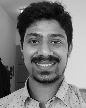
Raktim Ghosh (Student Member, IEEE) received the Bachelor of Engineering (B.E.) degree in mining engineering from the Indian Institute of Engineering Science and Technology, Shibpur, India, in 2016, and the Master of Science degree in geo-information science and Earth observation with a specialization in geoinformatics under the joint education program (JEP) between the Indian Institute of Remote Sensing, ISRO, and the Faculty of Geo-Information Science and Earth Observation (ITC), University of Twente, Enschede, The Netherlands, in 2019. He is currently pursuing the Ph.D. degree with the Remote Sensing Laboratory, Department of Information and Communication Technologies, University of Trento, Trento, Italy, and the Remote Sensing for Digital Earth Unit, Fondazione Bruno Kessler, Trento.
His active research interests are related to the automatic analysis of radar sounders data for investigating the subsurface features.
Raktim Ghosh (Student Member, IEEE) received the Bachelor of Engineering (B.E.) degree in mining engineering from the Indian Institute of Engineering Science and Technology, Shibpur, India, in 2016, and the Master of Science degree in geo-information science and Earth observation with a specialization in geoinformatics under the joint education program (JEP) between the Indian Institute of Remote Sensing, ISRO, and the Faculty of Geo-Information Science and Earth Observation (ITC), University of Twente, Enschede, The Netherlands, in 2019. He is currently pursuing the Ph.D. degree with the Remote Sensing Laboratory, Department of Information and Communication Technologies, University of Trento, Trento, Italy, and the Remote Sensing for Digital Earth Unit, Fondazione Bruno Kessler, Trento.
His active research interests are related to the automatic analysis of radar sounders data for investigating the subsurface features.View more

Center of Digital Society, Fondazionae Bruno Kesseler, Trento, Italy
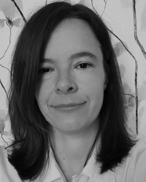
Francesca Bovolo (Senior Member, IEEE) received the Laurea (B.S.) degree, the Laurea Specialistica (M.S.) degree (summa cum laude) in telecommunication engineering, and the Ph.D. degree in communication and information technologies from the University of Trento, Trento, Italy, in 2001, 2003, and 2006, respectively.
She was a Research Fellow with the University of Trento until 2013. She is currently the Founder and the Head of the Remote Sensing for Digital Earth Unit, Fondazione Bruno Kessler, Trento, and a member of the Remote Sensing Laboratory, Trento. She is one of the co-investigators of the Radar for Icy Moon Exploration instrument of the European Space Agency Jupiter Icy Moons Explorer and a member of the science study team of the EnVision mission to Venus. Her research interests include remote sensing image processing; multitemporal remote sensing image analysis; change detection in multispectral, hyperspectral, and synthetic aperture radar images; and very high-resolution images, time series analysis, content-based time series retrieval, domain adaptation, and light detection and ranging (LiDAR) and radar sounders. She conducts research on these topics within the context of several national and international projects.
Dr. Bovolo is a member of the program and scientific committee of several international conferences and workshops. She was a recipient of the First Place in the Student Prize Paper Competition of the 2006 IEEE International Geoscience and Remote Sensing Symposium (Denver) in 2006. She was the Technical Chair of the Sixth International Workshop on the Analysis of Multitemporal Remote-Sensing Images (MultiTemp) in 2011 and 2019. She has been the Co-Chair of the SPIE International Conference on Signal and Image Processing for Remote Sensing since 2014. She was the Publication Chair of the International Geoscience and Remote Sensing Symposium in 2015. She has been an Associate Editor of the IEEE Journal of Selected Topics in Applied Earth Observations and Remote Sensing since 2011 and the Guest Editor of the Special Issue on Analysis of Multitemporal Remote Sensing Data of the IEEE Transactions on Geoscience and Remote Sensing. She is a referee for several international journals.
Francesca Bovolo (Senior Member, IEEE) received the Laurea (B.S.) degree, the Laurea Specialistica (M.S.) degree (summa cum laude) in telecommunication engineering, and the Ph.D. degree in communication and information technologies from the University of Trento, Trento, Italy, in 2001, 2003, and 2006, respectively.
She was a Research Fellow with the University of Trento until 2013. She is currently the Founder and the Head of the Remote Sensing for Digital Earth Unit, Fondazione Bruno Kessler, Trento, and a member of the Remote Sensing Laboratory, Trento. She is one of the co-investigators of the Radar for Icy Moon Exploration instrument of the European Space Agency Jupiter Icy Moons Explorer and a member of the science study team of the EnVision mission to Venus. Her research interests include remote sensing image processing; multitemporal remote sensing image analysis; change detection in multispectral, hyperspectral, and synthetic aperture radar images; and very high-resolution images, time series analysis, content-based time series retrieval, domain adaptation, and light detection and ranging (LiDAR) and radar sounders. She conducts research on these topics within the context of several national and international projects.
Dr. Bovolo is a member of the program and scientific committee of several international conferences and workshops. She was a recipient of the First Place in the Student Prize Paper Competition of the 2006 IEEE International Geoscience and Remote Sensing Symposium (Denver) in 2006. She was the Technical Chair of the Sixth International Workshop on the Analysis of Multitemporal Remote-Sensing Images (MultiTemp) in 2011 and 2019. She has been the Co-Chair of the SPIE International Conference on Signal and Image Processing for Remote Sensing since 2014. She was the Publication Chair of the International Geoscience and Remote Sensing Symposium in 2015. She has been an Associate Editor of the IEEE Journal of Selected Topics in Applied Earth Observations and Remote Sensing since 2011 and the Guest Editor of the Special Issue on Analysis of Multitemporal Remote Sensing Data of the IEEE Transactions on Geoscience and Remote Sensing. She is a referee for several international journals.View more


